Head
Siegfried Raasch
Flying small vehicles, like package delivery drones or urban air taxis in urban environments, requires good knowledge of the local meteorological conditions, especially mean wind (shear) and turbulence. To ensure safety for the vehicles as well as for the people onboard and on the ground, operations need to be conducted in suitable weather conditions within the design horizon of the vehicle. To avoid hazardous right away, detailed wind analyses should be incorporated in the planning and implementation phase of drone operations. This will help to identify sutiable landing and departure spots as well as safe routes.
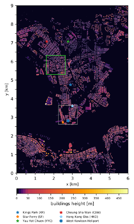
The Drone WAVES project aims to provide a framework how meteorological support for drone operations in cites can be realized practically with the help of large-eddy simulations. The focus is on the local turbulent wind field in Kowloon Peninsula, Hong Kong, which may significantly vary between flight corridors. Weather elements like rain, visibility, and storms as larger scale meteorological phenomena typically affect the whole airspace in the same way so that critical events generally require to completely interrupt flight operations or to apply restrictions to all flight corridors in the same way. Such decisions can be based on publicly available weather prediction or nowcasting products.
Sebastian Giersch, Omar El Guernaoui
Last Change: 29.11.21; Holger Schilke